Environment Canada has issued a winter storm warning across the Ottawa Valley.
Information this morning suggests the Renfrew, Arnprior and Calabogie area could see 25 to 40 centimeters of snowfall by Monday night.
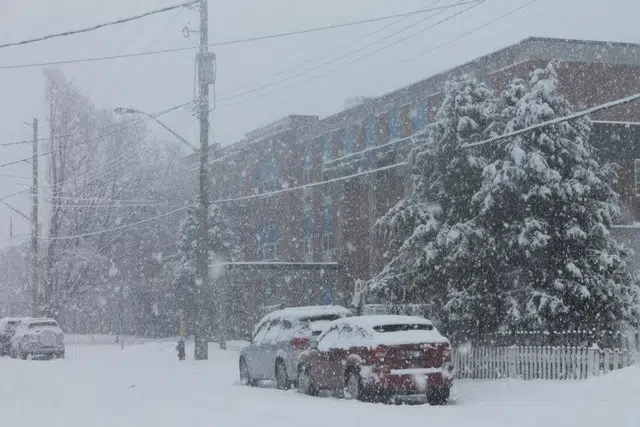
Snowfall rates of 2 to 5 cm per hour are possible Monday morning into the afternoon.
Pembroke, Petawawa, Cobden, Barry’s Bay, Killaloe, Bonnechere Valley and the surrounding area could see 25 cm of snow by Monday night.
Environment Canada has issued a snowfall warning for Deep River, Whitney and Eastern Algonquin Park with total snowfall amounts near 15 cm by Monday night.
Consider postponing non-essential travel until conditions improve.
Poor weather conditions may contribute to transportation delays.
Surfaces such as highways, roads, walkways and parking lots may become difficult to navigate due to accumulating snow.
Visibility may also be suddenly reduced at times in heavy snow.
Be sure to take frequent breaks and avoid strain when clearing snow.
A low pressure system tracking south of the Great Lakes will bring significant snowfall to the region.
Local blowing snow is also possible Monday afternoon and evening with gusty northerly to northwesterly winds.
More snow is also expected Tuesday night into Wednesday, but at this point it’s unclear how much additional snow will fall across the Ottawa Valley.
4:56 AM EST Sunday 16 January 2022
Winter storm warning in effect for:
- Renfrew – Arnprior – Calabogie
- Barry’s Bay – Killaloe
- Petawawa – Pembroke – Cobden
- Ottawa – Kanata – Orléans
4:58 AM EST Sunday 16 January 2022
Snowfall warning in effect for:
- Deep River – Whitney – Eastern Algonquin Park